History of ISS Tracker
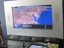
In the summer of 2006 I was contracted by TERC, a Boston based non-profit educational development firm, to create a javascript based utility to calculate the location of a satellite at any particular time. This javascript utility was to be used in a exhibit for the Smithsonian Air & Space Museum and the Boston Museum of Science to allow the public a glimpse of what the astronauts in the International Space Station would see when gazing upon the Earth.
During the development of the javascript utility I needed to create a simple user interface (UI) so that I could verify the accuracy of the outputs being generated. This UI was rather crude; the 2-Line Elements needed to be manually retrieved from external sources, then copy and pasted into the UI and every update needed to be initiated manually. This UI was the foundation of what became
In early 2007 I decided to get permission to use the javascript utility to bring the experience of the Windows on Earth exhibit to people at home. I extended the utility to add the ability to calculate the flight paths, secured rights to use the Daylight Maps and decided that in order to keep the website simple to use and understandable, that it would keep the options to a minimum.
Over the next 3 years viewership has grown significantly and I've been collecting feedback from fans of the website. Now as of late 2010 we have reached another milestone for ISSTracker.com, version 2.0.
With the onset of v2.0 of ISSTracker we have a larger map, adjustable flightpath durations, Metric and English Units of Measure, and now a visibility ring. The only feature to be lost in v2.0 is the daylight map, which is due to a lack of support of Daylight maps using the latest version of Google Maps. In time this feature may return.
Also with v2.0 of the website you'll notice the site is more then a single page website and there is now the Extras page. The Extras page is going to be where new features can be found that are are not ready for the Home page.